Blog Catalog

History Blogs - Blog Catalog Blog Directory

Followers

Saturday, May 14, 2022

Lake Bardwell


Looking North. Showing service bridge  piers and outlet works


Local residents of the Ellis County and surrounding areas in North Texas realized their future would require water conversation. This realization became Lake Bardwell. It was approved by the US Congress on March 31, 1960, to be built by the US Army Corps of Engineers at a cost of $12,630,000. In Today's money according to Morgan Friedman inflation calculataor, you are looking at 106 million dollars.  So this lake was no small project! Lake Bardwell controls 178 square miles of drainage in the area. The lake is 5.4 miles long, 1.2 miles wide at its widest, and the shoreline is 25 miles. 

"The state of Texas controls allocations of water from the conservation pool through the Trinity River Authority (TRA.) The Secretary of the Army approved a contract on June 24, 1963, authorizing the TRA to utilize 25% of the conservation storage space (10,700 acre-feet) as water supply for the city of Ennis. A supplemental agreement to the contract approved in October 1969 reallocated 60% of the water in the conservation pool to the city of Ennis and 40% to the city of Waxahachie. "-US Army Corps of Engineers


                                                           Looking upstream spillway slab
Lake Bardwell is maintained at 421 mean sea level as much time as possible. Lake Bardwell is becoming more and more a recreational attraction with population rising in the area. For details on the lake go to the Corps of Engineers link here

Sand Lake Tragedy

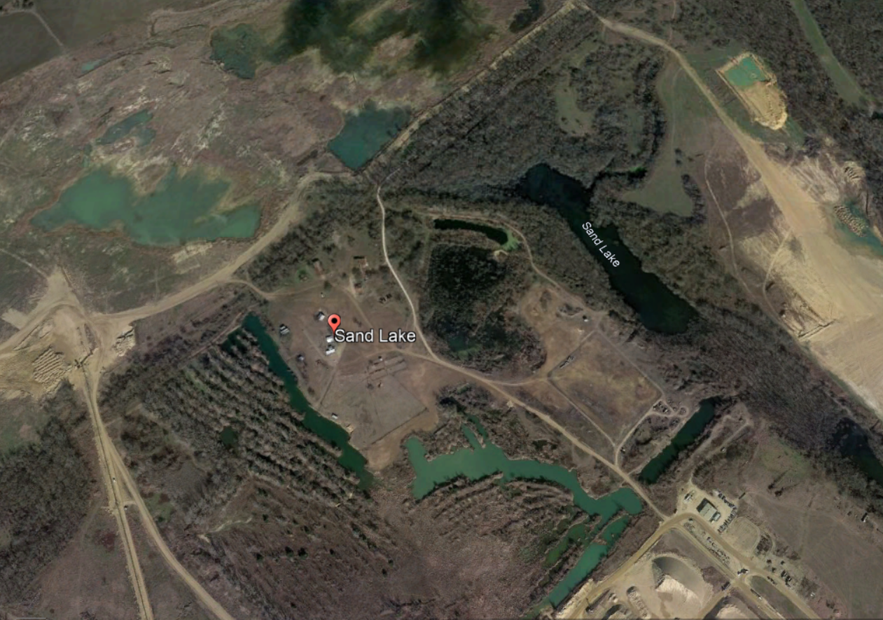
SAND LAKE
Sand Lake was a town named after a clear beautiful lake formed by the Trinity River. It's located east of Ennis off highway 34 near the Trinity River. It's not sure when the community started but there were records of a flood here in 1844. The old roadbed of the rail spur installed by the T. & N. P. Railroad was still visible there in 1976. The first time I heard about Sand Lake was from a retired Ellis County Detective who had grown up there. It appears on goolge earth there is still buildings left from the old town. In the 70's a post office building, black smith building, and a school building were noted to still be there. Now, it appears a sand company has bought the area and is selling the sand. Somebody had told me a story that prisoners had once tried to swim across the lake and drowned but I think the story below is the real story and it changed over the years maybe mixing events. What a horrible accident! These poor souls were just trying to enjoy the cold weather. What a horrible day for that family who lost so many. Anybody who grew up in cold winters in Texas and remembers seeing ice on a creek and was tempted to step on it. Skating, I would never imagine in Texas. Usually, in colder regions I believe people had a way of testing ice on lakes with poles and they also would have many days of below freezing weather that would make the ice solid.
Seven Drowned in Sand Lake by the Fort Worth Gazette, Jan. 20, 1888. ________________________________________________________________________________________________ Four of the women and one man were sisters and brother - the other couple also sister and brother. Ennis, Texas. Jan. 18. Reports were received here this evening that seven persons were drowned in Sand Lake, some ten mles east of here. Two young ladies, daughters of William Williams and a young man named Babbitt were skating on the lake when the ice gave way and they sank in six and a half feet of water. Miss Babbitt and two little girls, ages 9 and 13, daughters of William Williams, were also drowned attempting to rescue them. Another small child of Williams fell through the ice and was only saved by one of the drowning young ladies throwing it out on the ice. Mr. Williams, brother of the young ladies, who was a quarter mile distance, ran to their assistance but was overpowered by their struggles and also drowned. His mother, in an effort to save them, was pulled down and would have drowned were it not for the help of her two little daughters, eight and eleven, who threw her a rope and managed to pull her to shore. All the bodies were found together. Another account Garrett, Tex. Jan. 18. Conducto Easton, running between Ennis and Roberts on the Central, brings the sad news of the drowning of Mrs Babbitt's four daughter and one son and an elderly lady, name unknown, in Sand Lake near the Trinity River on what is known as the Faulkner farm, while skating today. It appears young Babbitt fell through the ice and the ladies while trying to rescue him went through also. All bodies were recovered. Ft worth Gazette Ellis County TxGenWeb

Friday, April 6, 2018

The first recorded white settler on Ellis County land - William Howe

William R. Howe came to Texas in 1839 from Lauderdale County, Tennessee. Howe was issued a conditional certificate, Number 1301, by the General Land Office Of the Republic of Texas on January 10, 1840. Howe claimed 640 acres on Chambers Creek between present-day Forreston and Italy. William Howe was a carpenter, blacksmith, shoemaker and a farmer. Constant attacks from "Indians" caused a delay in the building of his home. But after pushing the "Indians" west Mr. Howe could finish his house and by the spring of 1842 it was built.  It was a two-story house with two stone fireplaces. The house was built on the north side of Chambers Creek and close to the Military road surveyed by Gen. William G. Cooke. 77 and I-35 follow the basic path of the military road of 1841. I believe somewhere near the old rest stop may be where the Howe homestead originally sat. Today, there is a house and barn a little below the old rest stop. I am not sure if the property holds any remains of the Howe settlement. The rest stop has been taken down and is taped off as of today. The Howe cabin was a standout structure compared to many cabins you would normally see built by pioneers who needed to establish their homestead before a certain date. Mr. Howe ran the post office at one time for all of North Texas and his house became a stagecoach stop. The area was known as Chambers Creek after the nearby tributary of Trinity River. When William Howe settled his land he was in Robertson County in the Republic of Texas. After Texas was annexed in 1845 Navarro County was cut out of Robertson County on July 13, 1846. Chambers Creek became the county seat of Navarro County. Later, in 1849 Ellis County would be proposed then cut out of Navarro County in 1850 including William Howe's property. It was a true wildland when Mr. Howe settled on Chambers Creek. He also took in captured Native American children that would be used to trade for pioneer children captured by Native Americans. William Howe also brought the first slave to the Ellis County region named Reuben. Buffalo would hang out near the property so food was always available. Wild horses were there for the taking also. Native Americans would enter the properties claiming to be hunting but it was known they were likely there to steal horses the pioneers had collected. It was a time when a man could cut his own life out of the wilderness using his tenacity, skill, and pure will. For more info visit the Ellis County Museum in downtown Waxahachie where you can fund a small biographical sketch book on Mr. Willaim R. Howe for around $4. ~~~~~~~~~~~~~~~~~~~~~~~~~~~~~~~~~~~~~~~~~~~~~~~~~~~~~~~~~~~~~~~~~~~~~~~~~~~~~~~~~~~~~~~~~~~~~~~~~~~~~~~~~~~~~~~~~~~~~~~~~~~~~~~~~~~~~~~~~~~~~~~~~~~~~~~~~~~~~~~~~~~~~~~~

Friday, February 2, 2018

Bessie Coleman- First African American Woman Pilot (MSN Black History Month)


Waxahachie former resident, Bessie Coleman had an interesting short video on MSN for Black History Month.

https://www.msn.com/en-us/news/video/black-history-bessie-coleman-first-african-american-woman-pilot/vi-BBIyWUk

BESSIE COLEMAN QUOTES:
“I knew we had no aviators, neither men nor women, and I knew the Race needed to be represented along this most important line, so I thought it my duty to risk my life to learn aviation,”

 “The air is the only place free from prejudices.”

Here is a small Blog for Ellis County Texas story on this amazing woman.
https://blogforelliscountytexashistory.blogspot.com/2008/02/bessie-coleman-01261892-04301926.html

Saturday, January 6, 2018

The Mulkey-Loggins House - Ennis, TX is now in Midlothian, TX

          Mulkey-Loggins House picture from Waymarking.com


The Mulkey-Loggins House, 110 N Elm St, Ennis, TX. until October 2015 to be moved to Midlothian, Tx and restored.

 This property was part of a tract settled in 1854 by pioneer Philip A. Mulkey (d. 1862). Ennis was founded in 1871, when the Houston & Texas Central Railroad reached this point. Mulkey's son James (1859-1903), a prosperous cattleman, included this site in the Highland Addition, a neighborhood that he developed after Ennis became the railroad's divisional headquarters in 1891. Dr. James C. Loggins (1845-1921), mayor and city alderman, erected this Victorian residence in 1898. It was purchased in 1944 by Keith Mulkey, James Mulkey's grandson, and his wife Tina Beth (Wheeler). (1978)

I have worked next to the Mulkey-Loggins property for years and one time I was visited by some previous occupiers of the house. One told me as a child they had lived in the house and remembered cattle had been driven on a trail on the north side of the property where Wal Mart is currently. The old house had a water well  located on the north side of the property and the little girl would watch the cowboys get a drink of water as they drove the cattle into town.


The Mulkey family pleaded with city of Ennis to keep the house in Ennis. One family member was told "It's just an old house." So the City of Ennis decided to let it go.  A gofundme account was put together and money was raised but was unsuccessful. In comes an investor from Duncanville, Tx who owns FOUNDER'S ROW and saves the day! For a 117 years it sat in this location.  Now it's new location will be in Midlothian, Tx.  It was moved between Avenue G and Avenue F streets in an empty lot between 11th and 12th street. It is currently being remodeled and looks to be almost finished as of 2018.   The car wash is in now in at the houses original location and it almost seemed cursed at first. I thought the car wash would never open.  They had the gas line cut twice and had to move the whole sewer line around to get it in the right place. It opened a year later than expected. Here are some pics of the extraction.


Above in the car is lady who actually lived in the house. It was hard to watch for the nice lady  who grew up in the house. She cried when they started moving the quartered house but in the end history was preserved and in good hands.


Friday, February 17, 2017

The Shawnee Cattle Trai through Western Ellis County Marker


Driving through Italy, TX a week ago I decided to take a scenic route towards 5 points.  As I descended L R Campbell rd (Named for Lee Robert Campbell) to the Chambers Creek bottom I spotted a Historical Marker on the right.  "That was never there before!", I said to myself.  Its behind a wire fence at the entrance to Pecan Springs Ranch .  The ranch's website provides a lot of history of the Shawnee Cattle trail and the ancestry of the land in the Sims family.  A beautiful area if not the most beautiful area in Ellis County. The Shawnee Cattle Trail was the original cattle trail north.  I'm not sure if the trail actually follows the road but I do know the cattle drives varied because they had to find land that hadn't been grazed before and it was thought Western Ellis County was chosen because of the prairie lands and the many creeks and springs. I know that Buena Vista Road that connects Waxahachie to Maypearl was the basic path of a connector trail between the main cattle trails. Lots of interesting hard working cowpokes came through here. 


Thursday, October 23, 2014

Ellie May- Ellis County Mammoth

So there have been many news stories done on the Mammoth Ellie May found in between Italy and Avalon in Ellis County.  I've been googling all the stories and heard one where the guy on the dig say that three Mammoth have been pulled from Ellis County earth. One near Bardwell(I'm guessing when the Lake was built in the 60's but not for sure) and one in North Ellis County in the 1920's.But nothing as complete as this Mammoth.  http://www.usatoday.com/story/news/nation/2014/08/27/prehistoric-mammoth-unearthed-in-texas/14668027/      http://www.cbsnews.com/news/whole-mammoth-skeleton-found-in-texas/    http://www.waxahachietx.com/multimedia/video/ellie-may-the-mammoth-of-ellis-county/youtube_5dc0e044-403a-5371-a599-692d53c229f4.html


An added note I've been reading a book on Ely Green called "Too Black, Too White."  In 1912 Ely worked in Waxahachie for the Stone & Webster Company who was building a bridge for the North Traction Company.  While digging a hole for a pier "at ten feet he (Ely) dug up a rock that looked polished a weighed 10 pounds" Judge Dunlap was watching and asked to see it.  He proclaimed it to be a Mastodon tooth and that he would put it in the Sims Library.  I'm assuming this is the trestle that crossed Waxahachie Creek south of downtown.  Don't know if it ever made it to the Sims Library.

In the late 80's early 90's I walked out to the old brick factory in Ferris where the golf course is now.  On a hill where they got the clay for the bricks I found some vertebrae. I can't remember if I kept it or not.  Seems like I left it.  Surely, workers came across bones while moving the dirt there. 


Monday, September 16, 2013

TRUMBULL

Trumball circa 1968


You probably blow right past Trumbull on I-45 and don't think much about it. Well honestly, there really isn't a lot there. A Quiet community with maybe two or three businesses where chickens roam the neighborhood.The People who live there are pretty much considered to be in Ferris. Trumbull has always had a Ferris connection. In 1872 it became a switch on the Houston and Central railroad. In fact, the Engineer's referred to the town as "The Switch." Which means it really didn't have a name. Since the late 1800's Trumbull had gone by a few names. Three Mexican section hands(some say ranch hands) were killed on the tracks and buried on the near by Smith's property on the west side of the tracks. The graves were marked with steel rails. After this the town became known as "Ghost Hill." The Engineer , Mr Valley, would hang a red lantern out out of respect for the dead when he came through town.The town would go through two more names, "Mackie" and "Clemma", until It was finally named Trumbull in honor of J. A. Trumbull, a railroad official.

  In early 1900's a resident recalled that 16 coal burning passenger trains per day would come though Trumbull. Pretty good traffic and this allowed for businesses to thrive. Grocery stores, a saloon, a bank, and a doctor's office. In the early 1900's, the stores were in wooden buildings over by the railroad track. There were three groceries - one operated by L. N. Lee, who also had a small saloon inside. Another grocery store, owned by Jim Davis, had a soda fountain, and sold clothes, shoes and bolts of material. He was also a druggist, owned the first gas station in Trumbull, and a lumber yard on the other side of the tracks. Next to the grocery store was a restaurant, a barber shop (owned by Eli Whitley) and a doctor's office. The Texas Electric Railway came through about 1913 and you get your tickets at Mr. Perkin's store. The interurban station was a three-sided building. In 1954 there was the Trumbull Implement Co., Perkins Grocery store, a filling station, store and market, and a gin run by Larry Smith. The Trumbull Implement factory was owned by John Toal. It was said that he had an ingenious way of making plows. Some say that they were so well built that he put himself out of business because they lasted so long. The sons carried on the business until 1983.

 Originally the town had a log cabin school in 1912 east of town but eventually they built a fine two story brick school. I believe maybe in the late 1910's. I noticed many brick building were erected in this time period around Ellis county. A long time resident, Burnie L. Bailey, believes that the bricks for the school were delivered by train from Malakoff. The school was located just south of the main town. The aerial photograph above is taken from the west and the school would have been in a field to the right out of frame. The school taught up to the tenth grade. In 1945 the children were transferred to Ferris schools. Starting in 1945 Mexican cotton pickers up to 125 used the school building for living quarters. It eventually became abandoned and vandalized. I visited there in the late 1980's or early 1990's and saw the inside. Of course it was vandalized but we could still get up stairs. If my memory serves me right it had an auditorium up stairs. We were really surprised that it seemed like a very fine school for such a small town. In 1999 somebody burned it down and it was bulldozed. Now there is just a field for feeder corn  probably owned by investors that will sale it to the highest bidding gas station one day.
Thanks to Shanon Simpson from the Ellis County Museum for the pics

Monday, July 22, 2013

Ellis County North Western boundary 1878 - I-GN Railroad map

Internet searching about The International-Great Northern Railroad I found this map of 1878. Still shows Ellis County in it's original North west county line. The IGN Railroad would make some tracks in the west and southern parts of Ellis County in 1902.

Sunday, January 27, 2013

Waxahachie City Marshal John Henry Spalding deserves a Historical Marker

Yesterday driving down 342 I saw a large gathering of Lancaster police vehicles at 342 and old red oak road. I thought something had gone terribly wrong until I noticed cameras and smiling police officers. It appears the tragedy happened years ago to one of their own. City Marshal P.M. Solomon was struck down by an interurban train he was trying to flag down. There was a station called valley view at this spot on Nov 2, 1912. The City Marshal had got on the south bound train because the driver had alerted him to a drunk on the train. After they got the drunk into custody Marshall tried to flag down the north bound train back to Lancaster but was struck and killed.


 Makes me think that John Henry Spalding deserves a monument to where his death occurred in Waxahahcie, Tx. I believe the location of his murder is on Smokey Lane where Oldham's branch intersects. He was killed by the intoxicated Chas Smith while the Marshall was trying to apprehend him during a shootout. J H Spalding was an original pioneer of Waxahachie and served six years a s City Marshal until his death on December 17, 1882. Director Robert Benton is the Great Grandfather. Benton based the movie Places In The Heart loosely on the shooting death of his Great Grandfather. Dallas County Sheriff Assistant Deputy (Ret.) Terry Baker has researched and brought back respect to many forgotten fallen officers. Guys like him could probably get an historical marker put up for Marshal Spalding. Sheriff Baker actually has left his research in the Sims Library resources department.

Sunday, December 23, 2012

Johnson County Takes A Slice of Ellis County

A while back I was thumbing through the Ellis County Genealogical Society's Searchers and Researcher's fall 1996 issue. Found a guy named, Dan Barker, who was researching post offices in Ellis County. He had found that a number of post offices established in 1860 located in Ellis County's far western region had disappeared. He knew something was wrong. He remembered reading a small reference to border changes in Ellis County in one of the history books. He had not given it much attention until now. His research found that a border community Auburn (later called Antioch) had changed from Ellis County to Johnson County. I know that the Auburn cemetery is in Ellis County but I think it had moved some and then changed names. It was basically just a group of houses at one time. I found a Federal Census map of Texas where you can tell the Ellis County and Johnson County border change somewhere from the 1870 map to the 1880 map. It's hard to say when people actually started figuring out when they had changed to a different county. Probably when they paid taxes, vote or had to go to court. Mr Barker did say that if you were looking for people in these communities in the 1870 census they would be in Ellis County in the 1880 census they would be in Johnson County.----------------------------------------------------------------------------------- I believe the legislative act to give Johnson County the triangular slice of prime Ellis County farmland was proposed in 1869 under the Reconstruction government. It was a section of Ellis County's western border 19 1/2 miles long north and south and 11 1/4 miles east and west. About a 100 square miles of good Ellis County soil. Now how could this be?!! And why did Ellis County put up with it? Hans Smith and his son's had gathered the 100 signatures needed to form Ellis County out of Navarro County(Which everybody knew Navarro would be divided up because it was way too large of an area in 1849 to have a government represent it's people. Just like Robertson and Milam were divided up.) Representative General E. H. Tarrant(The Indian fighter for whom Tarrant County is named) introduced the act to create Ellis County and the legislative act to create Ellis County was signed by Governor Peter Hansborough Bell on December 20, 1849.------------------------------------------------------------------------------------------------------------------------------------------------------------------I think that the Reconstruction government, like the controversial Governor Edmund J Davis, pretty much did what they wanted to do. The story goes that Johnson County was whining about being forced to give up half of its land to Hood County. In 1866 by act of 11th legislation of Texas, Hood county was formed comprising of 623 sq miles of Johnson County land. Pretty much half of Johnson County. But at least it did form another county. Later in 1875 Somervell County was cut out of Hood. Johnson County complaining they lost so much of their land they proposed to take the western section of Ellis County.  Governor Edmund J. Davis approved the act on March 25, 1871. This was a purely unnecessary land grab. It wasn't to form another county it was to appease somebody in Johnson County. So, many towns changed their county during this time from Ellis County to Johnson County. Here is a list of some. Antioch( Auburn), Barnesville,Bradley,Cahill, Caleb, Cope Cemetery, Crill Miller, Cotton Valley, Cross Timbers,Gossip, Griffith Switch, Heugh, Hines, Lillian, Myers settlement, Pleasant Point, and Truelove. -------------------------------------------------------------------------------It didn't end here. Well into the  1880's the boundary between Johnson and Ellis came in to dispute again. Apparently, when a border between counties is surveyed a surveyor representing each county must be employed to work together. Through the General Land Office I got information that on 5/29/1882 it was noted by the Johnson County surveyor that the Ellis County surveyor did not show up. The notes of the Johnson County surveyor gave my General Land Office source the impression the boundary was still in dispute. It is said that in 1887 the Johnson-Ellis County line dispute got heated and not until 52 years later in September of 1939 did it peacefully get marked and recorded into the State Land Office. Apparently three other lines had been made but were not the proper ones. The Surveyors had to go by the instructions of the act of 1869. The lines were marked with 10 foot Corner markers that were placed six and a half feet deep into the ground with the county's names on the side(I wonder if they are still around?) and then adjoining markers were set in the 19 mile line. They were five foot concrete posts set three feet deep in the ground. Bois d' arc post were placed in the ground every mile. County officials had to figure out back taxes to areas that had been paying the wrong county. What a mess! ----------------------------------------------------------------------------------------------------------------------------------------------------------------------------------------Today, it is interesting to think about this triangle slice of land. It was upsetting for Ellis County to unfairly loose the prime farm land. But how upset do you think old citizens of Ellis County would be if they would have known that in the 21st century the Barnett shale would be the boom of our times and this piece of disputed land is a core section of it. Midlothian sits right on the Ouachita Overthrust  west of it where the land drops is the flat land that was taken from Ellis County and is part of the Ft Worth Basin. This land is full of the Barnett Shale which is full of natural gas which makes people's pockets full of money. Border War? Glad it was finally settled before they knew that it was there. I believe wildcatters found the gas in the 1950's but didn't have the technology to get it. I got a few maps to show the border change, the section stolen form Ellis County, gas wells (pooling) and one that shows the Barnett shale.

  ----------------1850 federal census map-----------------------
-------------------------1880 federal census map-------------------------------

                                                           My outline of the stolen section
                                                        Gas wells in the stolen section..
                                              ----Barnett Shale locations---------

Thursday, April 12, 2012

Capt R. D. ApRice

Read about an interesting Character, CAPT. R.D. ApRice, in the History of Telico, Tx book. A nice lady who was project director of the book let me borrow it. I was hoping to purchase a copy but don't know if there are more available.

Telico was known as Trinity City before the civil War. It was generally in the same area. Trinity city was formed in 1849 (technically in Navarro County but not for long. December 29,1849 it would be in Ellis County)with 118 blocks laid out. The Telico Manufacturing company was formed here with assests of $200,000. They manufactured wool, cotton, and lumber. Trade was back and forth with Galveston. The Trinity River was not known for being the best navigable river. Light draft steamboats would be the most common water craft for business. The largest was the "Welshman" and owned by Captain R.D. ApRice whos was originally from Wales. It was a double-decker steamboat. The Welshman was known to travel as far up as Dallas. Captain ApRice saw the Trinity as a practical transportation route for people and commerce. He surveyed the Trinity all the way to Trinity City where he made a port. When Dallas grew he made Dallas his last stop to trade with the Gulf. Then the Civil War came and ended the business with all the blockades. The Captain moved to Italy, Tx. He was involved with supplying ammunition for the Confederates from Ellis County. ApRice also became a Justice of the Peace. He had the contract for the third Ellis County Courthouse in 1870 under the Reconstruction's Police Court. They needed offices badly during the Reconstruction. The Stone for the Courthouse was to be local and ApRice found a quarry at S.A. Clifton's place two miles east of Waxahachie, Tx. It was a hard native yellow limestone and ApRice was to be responsible for quarrying the limestone and building the foundation. If you go to the basement of the current Courthouse you can still see the third courthouse foundation. John Solon was given the duty of cutting the stones. ApRice is said to be buried north west of Italy about 4 miles. He also had the abilities of a mechanic and had written poetry.

I have recently found the burial spot of R. D. ApRice in Italy.  He is buried in the Clay- Bell cemetery on the back of private property off of R L Campbell Rd. I would advise asking permission before venturing down there so not to surprise anybody. By coincidence I met some of R D's descendants.  They don't own the property around the cemetery they just happen to be there to find relatives.  I was told by a Mr. Bell  that ApRice was a Welsh way of saying the son of Rice or some version of that.  In documents you will see his name written"R. D. Ap Rice." I also would like to note that in the 1870 census he is documented as "Richard" for his first name. Mr Bell told me R D's mother is buried their with a large Obelisk grave stone.  It is very well kept graveyard down a hill.  I asked the relative if he knew why ApRice sank his steamboat.  He said that an old family story was that a wife had drilled holes in the boat and sank it.  I don't know if he had more than one wife.  But it makes a good story.

Regarding the Welsh patronymics, I found this on ancestry "A number of Welsh names being with P which come form the Welsh way of patronymics. That is, they said, "David ap Morgan ap Griffith ap Hugh ap Tudor ap Rhice" — ap meaning "son of." The "a" in ap was often dropped, and that accounts for the frequency of the surname starting with P. This how Hugh became Pugh; Powell is from ap Howell, Pritchard from ap Richard, and Price from ap Rhys."

Capt R D AP Rice grave


Monday, October 4, 2010

Places In The Heart -The Real Story


Even if they didn't see the movie, folks who lived in Ellis County in the early 1980's probably remember hearing about a movie being made by a Waxahachie's own, director Robert Benton. The town of Rockett was all a buzz when such actors like Sally Fields ( won the Oscar for her performance), Danny Glover, John Malkovich(nominated for Oscar), and Ed Harris were filming down FM 813 at the old Gibbon place. It all came to being by the inspiration of Waxahachie History involving Robert Benton's great grandparents.

Robert Douglas Benton was born September 2, 1932 in Waxahachie, Texas. Mr. Benton's mother, Dorothy (Spalding) Benton, has deep family history in Ellis County. Dorothy's great grandfather William W. Parks was District Clerk of Ellis County circa 1861 and became captain of the first company of confederate soldiers to go fight. Captain William Woodruff Parks died near Little Rock Arkansas December, 1862. It is Dorothy's grandfather, J. H. Spalding, for whom Royce Spalding is based. Places In The Heart was written and directed by Mr. Benton. It is also is a shadow of his ancestry. The story Mr Benton created takes place in the 30's while his great grandfather's real story took place in the 1880's. There was no intention of hiding the connection.
The 1880 Federal Census has John H. Spalding living in Waxahachie, Texas at age 44. He is head of household, and his occupation is City Marshal. John is shown to have been born in Missouri. John's parents are recorded to be both from Kentucky. John's wife is named Laura at age 31 and is listed as a homemaker born in Tennesse as was her parents. Their son Willis is age 10, son Clint is age 9, daughter Kate is age 7 and son Frank is age 2. All children born in Texas. Also, there is a visitor named Barbay Hammond age 60 from Alabama in their home at the time of the census. Little did the family know that two years later their life would be turned upside down on a December evening. In a Ellis County History book a section about Waxahachie written by Judge A. R. Stout and Edna D. Hawkins states that the founding families of Waxahachie were "E.W. Rogers, J.D. Templeton, W.H. Getzendaner,B.F. Hawkins, Nicholas Oldham, N. B. Langsford, J. B. Meredith, C. D. Puckett, Levin Dixon, R. A. Davis, N. P. Sims, J. P. Kennedy, Peyton Nowlin, M. T. Patrick, Silas H. Kilough, and J. H. SPALDING"

It was a Sunday December 17, 1882 in Waxahachie, Texas when an intoxicated Chas Smith would resist the arrest of a deputy marshall L. K. Allen. Chas Smith was a black man from Freedman town east of downtown Waxahchie. He worked for E. A. Dubose at his drug store. (Dubose was the six Mayor of Waxahachie serving from 1882 to 1888)Chas also did odd jobs around town. But it was Sunday and Chas was not working but was able to acquire alcohol and was apparently a mean drunk. Chas apparently arguing with another blackman probably on the corner of main and College st. The Deputy tried to arrest Chas when he decided to make a run for it. Chas ran north up college street from downtown. The Deputy fired a warning shot as Chas crossed a bridge which would have been near where the present day college street pub sits. The intoxicated Smith believing he was being shot at returned fire from his .45 pistol. I don't think the deputy thought Chas was armed and figured he would have just stopped after firing the warning shot. Chas was taunting the deputy and firing back. A gun fight ensued and the deputy and another citizen pinned Chas in the cotton platforms that would have been on the north side of the tracks east of college street where the parking lot for C. A. Wilson is currently . The deputy ran out of bullets and now he was pinned.

Whether or not Marshall Spalding was eating his Sunday dinner when the shoot out started is unknown. It would have been 6:30 pm. John and Laura Spalding's house on the corner of Jefferson and Hawkins street was maybe half a mile from where the shoot out started. This made it very possible that the Spaldings could have heard the shootout start from their house. The eyewitness accounts say that Marshall Spalding came onto the scene on horseback and firing at Chas Smith. Chas Smith went on the run and headed east towards a lumber yard that was near the tracks. It's possible that Marshall Spalding wounded Chas Smith. The Marshall overtook Smith at a bridge north of the tracks. I think that the Marshall believed he had injured Chas Smith and that he would comply to surrender. At the same time the Marshall dismounted his horse he started to grab Chas Smith. In response Chas Smith unexpectedly slung his pistol into the temple of Marshall Spalding and fired the .45 caliber pistol. Marshall Spalding instantly perished. Chas ran into Freedman town heading towards his home. He passed the black folks baptist church which is still on main street today. Not sure if it is the same building but believe it is same location. A large group of citizens hunted Chas down and found him resting under a peach tree. Chas was flushed out and took refuge in an outhouse. Chas refused to come out and a black man named Charlie Woodard involved in the chase busted the door down. It is said that the posse ordered Chas to surrender but he pulled out two pistols. The posse responded by riddling Chas Smith's body with bullets and shotgun fire before he could even take aim. I was informed that abuse of Chas Smith's corpse did happen similar to character in the movie by dragging him through the streets. The difference in reality and the movie was that Chas Smith's body was dragged by horses not a car. The enraged posse dragged the body to Jefferson and Hawkins street to show Mrs Spalding that in their they way to show her they took care of the matter. Probably their way to send a message to the black community also. There seems to be no mention of race tension. I could imagine emotions ran high in the community and not having the town Marshall to calm things down were stressful on the community.

The town was in shock and papers around Texas and other states reported the story. The Waxahachie paper had an article that claimed who ever sold the alcohol to Chas Smith on Sunday was the one to blame. The devil had entered Chas Smith by letting his guard down with alcohol. There wasnt any race arguments used in the article. There were no signs that the community blammed Chas Smith's race. It was illegal to sale liquor on Sunday in this time period. This and other violent incidents spurred on the Waxahachie's temperance movement of the time.

In the movie John Malkovich plays a blind man they call Mr. Will who was wounded in WWI. Through email correspondence with Robert Benton's secretary, I was informed that Mr. Will is based on Mr. Benton's grandmother's brother who was blind from childhood named Uncle Bud. The name "Mr. Will" probably came from a relative W A Spalding who was known to be called Mr. Will.

Laura Spalding did not physically run the farm like Edna Spalding but she was a strong woman. She owned a farm near Maypearl.  She did successfully manage the farm.  Laura with her older sister raised her three younger sisters after their Dad, Captain William Parks, died in the Civil War and her mother passed not long after. She was given recognition as a school teacher and much respected in the community. It appears she never remarried.
Some other interesting facts about Places In the Heart.. The were scenes not used in the movie. If you notice at the dance/party there are guys getting alcohol I believe from the back of a vehicle. Well, according to Director Robert Benton's through his assistant there was a draft of the movie with bootleggers that were to be based off the Director's father's two brothers. It's also said the Ellery Benton,Robert Benton's father, attended both Bonnie and Clyde's separate funerals. Wayne and Margaret's daughter, Rosalie, is said to have gotten the name Mr. Benton's wife. The Shooting of Royce Spalding in the movie takes place on the railroad tracks. In the background is the viaduct. The viaduct was officially opened for traffic by Mr Benton's great Uncle, W A Spalding Sr who was an engineer, on December 12, 1931. In the movie, the mean old Banker that turns down Sally Field for the loan (the Rogers Hotel was used as the bank)is W A Spalding Jr. At the end of the movie W A Spalding Jr and his wife are in the church. W A Spalding's wife is in many of the dance scenes. Other possibilities of family connections are the youngest son of John Henry Spalding was named Frank Evermont Spalding his first wife's name was Edna. Probably where those character's names came from. Also the scene references Sally Field's character had come into town to sell 5 lbs of potatoes to Mrs Parks. Parks is the real Laura Spalding's maiden name.

Director Robert Benton's ancestry
John Henry Spalding (April 29,1835)
married Dec 30th 1868
Laura Jane Parks (December 22, 1848)

to

Clinton Thomas Spalding (Feb 8th 1871)
married June 28th 1900
Willie Strong Spalding (April 19th 1875)

to

Dorothy Spalding (July 17, 1901)
married Oct 8th 1921
Ellery Douglas Benton (Jan 3, 1895)

to

Robert Douglas Benton (Sep 29, 1932)

Sunday, October 3, 2010

Strickland House

Overhead doors for front room in Strickland house

Hidden Door in the Strickland House

Monday, August 30, 2010

ALL ABOARD AT THE CHAUTAUQUA !!

ALL ABOARD

2010 Assembly Schedule
All Aboard! Rail Transportation - Yesterday, Today & Tomorrow
in Waxahachie & Ellis County
Saturday, September 25, 2009
Click here to purchase tickets BUY TICKETS


1:00 p.m. Opening Ceremony
"John & Sally Strickland," emcees
portrayed by Ryan & Charity Mullican

1:15 p.m.
Robin Cole-Jett, Director of Education
Museum of the American Railroad


2:00 p.m.
The First Interurbans Amazed Cows and People Alike
Robert L. Haynes, Curator
Plano Interurban Museum

2:30 p.m. The Interurban and its Influence on the North Texas Area Johnnie J. Myers, Author
Texas Electric Railway
3:00 p.m.
Rail in Waxahachie: Today & Tomorrow
Clyde Melick
Director of Planning, City of Waxahachie

4:00 p.m.
Melodrama: Dirty Work at the Crossroads
Waxahachie Community Theatre

7:00-9:00 p.m. The Levee Singers in Concert
The Levee Singers
(watch a video sample)

ASSEMBLY DAY ACTIVITIES


1:00-5:00 p.m.
Children's Activities in Getzendaner Park
Bounce Houses and Trackless Train Rides
Built For Fun

1:00-3:00 p.m.
Plein Air Painters
Original Art Show and Sale


1:00-5:00 p.m.
Rail History Memorabilia
Garden Trains
Scale Model Train Exhibit


5:00-7:00 p.m.
Dinner in the Diner
Catered Dinner and Pie Social in Getzendaner Park

CLICK HERE FOR TICKETS FOR DINNER

Monday, January 25, 2010

Argyle William Tucker- Midlothian's Genius


When I walk among grave stones I can't help but wonder, "What were these people like?" Surely, if they were exceptional people I would have heard about them or at least they would have a special marker by their grave. But the truth is many exceptional people are often forgotten. Yet even though the public forgets, sometimes family members pass on their story. Such is the case of Argyle William Tucker. A man of his times and a man before his time.

Thanks to Bob Bigham's articles published in the Weatherford Democrat, his great-great grandfather, Argyle William Tucker, has his place in Texas History. A set of articles written by Mr. Bigham, circa 1992, documents his family ancestry in Texas. Bob was influenced by his childhood memories of his Grandfather sitting around telling stories about their Texas pioneer family. You can imagine the impression made on a 7 year old Bob when his Grandfather, Albert Hall Bigham, placed a Winchester model 1873 45-60cal rifle in his hands. Especially after Bob heard the stories of how the owner of the rifle had fought indians in the pioneer days of Texas. The fact that the original owner of the rifle, A. W. Tucker, was Bob's great-great grandfather just enhanced the mystique.


Argyle William Tucker was born on September 9, 1832 in Davison County, Tennessee. His parents were Labon Epps Tucker and Nancy N. Turney. Labon's father ,Gabriel Tucker, was from a wealthy southern family from Georgia. Labon's grandfather ,Rev. Daniel Tucker, of Elbert County Georgia is believed to be the main character in the folk song "Old Dan Tucker." In the lyrics Old Dan dies from a "toothache in his heel."

"Daniel Tucker was buried in Elbert County in 1818.[51] The Elbert County Chamber of Commerce today promotes his grave as a tourist attraction due to his possible connection with the character from the song"-Wikipedia.
[Argyle Tucker in photo right]

Argyle with his parents and siblings moved from Lincoln County, Tennessee to Texas in 1854. They settled in Ellis County in the town of Waxahachie. Labon purchased a two and a half acre lot near the town square from Emory W. Rogers an original founder of Waxahachie. Here Argyle met and ,a couple years later, married Marinda Jane Stewart on November 14, 1856. In 1857 the whole family moved to 160 acres of land near a fort in Parker County that was eight miles west of Weatherford, Texas . A rough and tumble land with constant attacks by Indians, the Tucker family all being great machinist, began making guns to protect the pioneers. The Tucker's were men of rare ability and it was said they were so gifted that they could build a watch from scrap metal.
Argyle,"his father, and his brother Elihu established a gunsmith shop in Weatherford, L. E. Tucker and Sons.">-Handbook of Texas online
Argyle wanted to do more than build the firearms and joined the Texas Rangers under John Robert Baylor. Argyle became known as an Indian fighter as he fought in many battles. The approaching storm called the Civil War changed the fight from the Indians to the northerners. The Tuckers were proud to be from the South and Argyle and Elihu quickly joined the Texas State Troops. But the Tuckers were in great demand for their gunsmith skills and Labon and his sons main focus was making guns. They made as many firearms as they could for the Southern cause. Argyle also delivered supplies to military camps in the area.

The Military Board of Texas headed up by Governor , Richard Lubbock, was looking for people with gunsmith skills. The Lieutenant Governor of Texas, John Crockett, was give instruction to find folks with these skills. The Tuckers being well known for their talents were contacted. The Tuckers were convinced to form a partnership and come to Lancaster, Texas to set up a gun factory. Their business was called Tucker Sherrod & Co. of Lancaster, Dallas County, Texas. Their contract required them to manufacture 3,000 pistols in the likeness of the Colt.
"Tucker and his father created a gun known today as the Tucker or the Tucker and Sherrard-a .44-caliber pistol with a 7½-inch barrel, a copy of the famous Colt Dragoon, prized by collectors."
- Texas Handbook online


The partners of the company were as follows Labon E. Tucker, J.H. Sherrard, W.L. Killen, Pleasant Taylor, A. W. Tucker and John M. Crockett. The Gun Factory was set up on West Main Street in Lancaster. The Tucker's quit the business because as the war progressed supplies were hard to come by. The Tucker's were convinced to stay on as employees because there was such a need for their talent. Due to lack of materials the factory was unable to fulfill it's contract and was released from it's obligation. Since so few firearms were made the Tucker and Sherrard Colt became very rare and collectible. Argyle and Labon went back to Weatherford and reopened their gun shop. Again the gunshop is called L.E. Tucker & Sons.

The gun shop continued to make firearms as the war was coming to it's end. It was apparent the South was loosing and the Tuckers, who usually only accepted gold for their services anyway, decided to turn away Confederate money. At this time people of the South were very suspicious of anything they perceived as anti-confederate. The Tuckers fell under suspicion. To add to the suspicion, Argyle had served in the Confederate Army for a spell under a fella named Luckey who was under investigation for treason. Somehow the Tuckers and Luckey were arrested and tried in Houston for treason but all charges were dropped. Luckey was arrested again in Bell County ordered by a Judge Hunter in Weatherford. As the men were escorting him back to Weatherford they were headed off by a group of fellas who hung Luckey from a tree. Not very lucky was Luckey.

Argyle continued his service for the Confederacy and reported for duty in Galveston. After that Argyle was sent to Waco to build a cotton mill to make uniforms for the Confederate Army. He got the mill operating but the war soon ended. Elihu was serving in Marshall, Texas where he built a powder mill. He traveled to Waco after the war and all the Tuckers reunited in Waco. The Tuckers eventually moved back to Ellis County and Elihu and his family to Parker County.

Argyle settled in Midlothian and began the first Black Smith shop in Midlothian. He also opened a Grocery store and a Hardware store. Argyle opened the first photography studio and art gallery in Midlothian. Argyle would end up with 11 patents with the US patent office. Many patents involved farming equipment. In photography he designed a way to make electric gold pictures. Other patents involved a suspension bridge , a calculator and a railway switching device. [Blueprint of Tucker calculator in picture left]


Argyle and his brother also owned and worked on a gold mine in North Carolina in the 1880's. Argyle and Elihu in another venture built and ran a boat on the Paluxy River. Their boat was called the "Floating Palace." People would travel miles to Glen Rose and ride the "Floating Palace" enjoying music and dancing.

In 1910 Argyle William Tucker died at his daughter's home in Midlothian. He is buried in the Midlothian Cemetery. His youngest son Hughes H. Tucker carried on the his family's gifts of intelligence and ability. Hughes became a renowned geologist and was the head geologist on the Santa Rita #1 well in Reagan County, Texas. I'm guessing he marked the spot for the well to be drilled. It produced oil from May 28, 1923 until it was plugged 1990 . Santa Rita #1 oil well was on property leased by the University of Texas. This well made the University of Texas one of the richest colleges in the World!


Argyle Tucker's Patent for Gold Pictures


Resources:The Weatherford Democrat circa 1992, Handbook of Texas Online, http://www.westexmusichof.com/history/other_oil.html, Searchers Waxahachie Library

Thursday, June 18, 2009


Located in the Singleton Plaza parking area. Downtown walking tour pamphlet calls the 1885 Waxahachie jail a Calaboose. South Western term for a jail. Though the jail was made with boards the construction was based on log cabin construction. Boards were stacked to make the walls. Made the walls thick and sturdy. Even thwarted an attempt by prisoners to burn their way out.

The pamphlet says this prison was mainly used like our modern day "tanks" on Texas OU weekend to hold drunks. Back when Waxahachie was saloon plenty this little Jail stayed pretty busy I imagine.

Friday, June 12, 2009

The Summer Moonlight Movies :Places In The Heart

Today Friday June 12, 2009 The Summer Moonlight Movies are showing PLACE IN THE HEART in downtown Waxahachie near the Pocket Park at the corner of College and Franklin Streets. They use the inflatable screen. It will be real interesting and surreal considering the real story took place in 1882 with a shoot out that started on College street.
Powered By Blogger